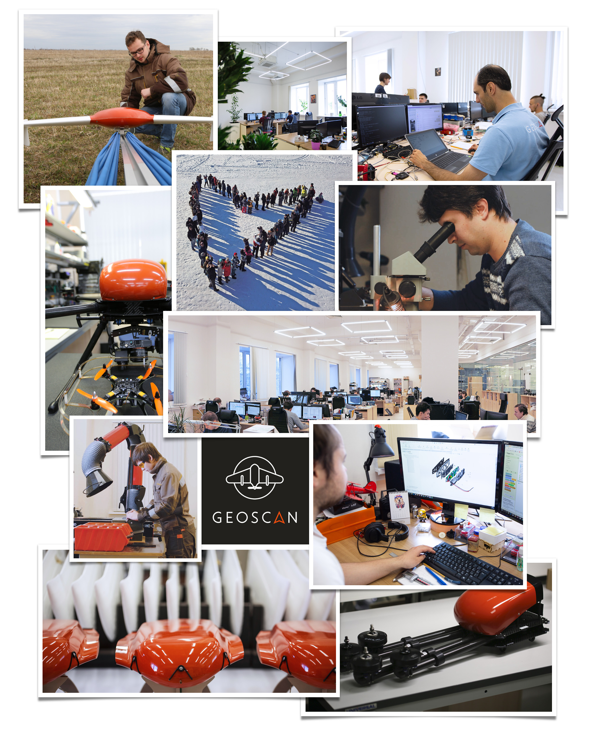
About us
Geoscan stands as a group of Russian technological enterprises which specializes in the design and fabrication of unmanned aerial systems, miniature satellites (CubeSats), avionics, wireless communication systems, and the engineering and assembly of unmanned systems and indoor navigation devices for STEM education and robotics competitions. Moreover, Geoscan’s expertise extends to services in unmanned aerial photography, which include multispectral and thermal imaging, airborne laser scanning, geological exploration, and aerial displays.
By consolidating the development and manufacturing of UAVs, CubeSats, their intricate components, and software under one roof, Geoscan attains remarkable specifications for its final products.
The array of Geoscan Group offerings spans across diverse sectors:
- Generating intricate 3D renderings of terrains and structures for urban planning, mining, and construction surveys.
- Producing orthophotomaps for cadastral mapping and land supervision.
- Monitoring pipelines, roadways, and power distribution networks.
- Crafting vegetation index maps to facilitate precision agriculture.
- Conducting comprehensive forest inventories and assessments.
- Detecting thermal anomalies and emergency situations within residential and utility infrastructures.
- Undertaking magnetic and gamma-ray spectrometric surveys for geological exploration.
- Providing real-time video surveillance in times of crises.
- Extending robotics education programs to students ranging from schoolchildren to those in higher education institutions.
The reach of Geoscan Group’s products and services extends to over 40 countries across the globe.
Records
- Undertaking the world’s most extensive UAV project: creating an intricate 3D representation of the entirety of the Tula Region in Russia from 6,000,000 aerial photographs captured by drones (NTI project).
- Initiating the world’s largest unmanned exploration project: obtaining imagery over an area of 1,250 square kilometers in Siberia.
- Orchestrating the world’s greatest drone show: commemorating the 75th anniversary of Victory in the Great Patriotic War with a fleet of 2,198 drones flying above St. Petersburg.
- Creating the world’s largest 3D model of a cultural heritage site: reconstructing the ancient city of Palmyra in Syria.
- Launching Russia’s first commercial satellite with the capability of deploying other spacecraft into orbit.
- Registering drones in the State Register of Measuring Instruments for the first time in Russia.
- Pioneering a unique technology for the comprehensive surveillance of power transmission lines using UAVs.
History
2023
- Obtained a UAS operator’s certificate
- Geoscan201, Geoscan701 and GeoscanGemini are the first technical means of aerial photographic survey in Russia
- New product: Geoscan Arena competition ground
- New UAVs modifications: Geoscan 701 Video, Geoscan 201 Video, Geoscan 201 T and Geoscan Gemini M
- Geoscan 801 quadcopter enters serial production
- The StratoSat TK-1 client satellite is the first cubesat in Russian history to place other spacecrafts into orbit
- Aerial photography of 525 settlements in Stavropol region
- Inventory of a hundred of solid waste disposal sites in seven federal districts of Russia
- Digital topological map of the Leningrad (8,390,800 ha) and Novgorod (5,450,100 ha) regions for the Ministry of Agriculture of the Russian Federation
- Geophysical exploration at 47 license areas, more than 41,000 linear km in different regions of Russia and abroad (in Kyrgyzstan and Saudi Arabia)
- The drone show in Kazakhstan, the largest in the country’s history
- Geoscan has supplied Geoscan Gemini to a total of 36 Rosreestr offices, and Geoscan 401 Lidar to Vietnam
- Geoscan equipped the Federal Center for Unmanned Aerial Systems in Rudnevo Industrial Park
- Geoscan became resident of the Lomonosov innovation cluster and the largest children’s technopark in Russia
- Joint network training program with the Aviation Training Center Profpilot and a new training center in the Lomonosov cluster
- Geoscan has supplied educational equipment to more than 500 schools, 30 colleges, and 10 universities in Russia’s regions
- Geoscan was included in the list of the nationwide project «Achievements.rf»
- Geoscan won the Architecture of the Sky Award
- Geoscan hosted three major scientific conferences on unmanned technologies in Tomsk, Khabarovsk, and Moscow
2022
- New products — industrial video copter and modem 3D Link BF
- Geoscan-Edelveis — the first-ever private spacecraft from St. Petersburg to enter orbit
- Delivered Geoscan Gemini to fifty territorial departments of state land supervision and equipment to the first Russian Federal tech park of professional education
- Developed a unique remote format for robotics competitions (realized at Cyberdrome and RoboFinist)
- Won the Industry Award
- Aeromagnetic and aero-gamma-spectrometric survey at the altitude of 4,500 m in Kyrgyzstan
- Aerial survey, including multispectral, in seven provinces in the South of Russia (80,000 ha)
- Surveyed heating networks in 11 administrative districts of St. Petersburg
- Aerial photography, aerial laser scanning and panoramic surveying of 28 landfills for municipal solid waste in eight regions of Russia
- The biggest show in the UAE (2,200 drones), the most technically sophisticated show in Al Ula, the first shows in Egypt and Peru
- Took part in 67th Russian Antarctic Expedition
- Developed a program for school students education and a professional development program for teachers
- Organized own robotics competition «Hello, Pioneer!»
2021
- New products — Geoscan 701, multispectral camera Geoscan Pollux, gamma-ray spectrometer GS-1
- New development in the work — designing educational CubeSats
- Conducted the first Russian programme for collecting names to send them into space on CubeSats in 2022 (22 772 applications from around the world)
- Reward «High Tech Exporter of the Year»
- Reward «For Dynamic Business Development» among small businesses
- Broke into Top 3 best world companies organising drone shows
- First place in the Over 1000 Drones nomination and a special prize for the exceptional contribution to the international drone show industry development
- Aerial survey of five regions in Leningrad Province (more 1 000 000 ha) and Vladivostok agglomeration (86 000 ha)
- Aerial and multispectral survey about 6000 ha of vineyards in Armenia
- Geoscan 201 helped to detect more 1000 archaeological objects
- Aeromagnetic survey in Burkina Faso, Kazakhstan and nine regions in Russia
- Became one of the key technological and infrastructure partners of the project to create carbon polygons throughout Russia
- 3D models of Kizhi, historical landmarks of Dagestan and Christian monuments in the Nizhny Novgorod Province
- Together with the Institute of the History of Material Culture of the Russian Academy of Sciences completed the creation of a 3D model of the citadel of Damascus
- Gemini began to be used in the search and rescue squad Extremum
- Launched an online store for retail clients
- A new rental format with Gemini, Lite and Geoscan 201 being available for subscription
- Designed radio modems with an operating frequency of 2.4 GHz
- Acted as participants and technology partners of many educational projects
- With the support of Geoscan, a new round of development of the competence «Piloting and operating UAVs» WorldSkills Russia was launched
- Became partners of the Wings of Kindness programme for school children and children from orphanages and boarding schools
2020
- World record for the number of drones launched into the sky simultaneously (2,198 copters)
- The world’s largest unmanned exploration project (125 000 ha)
- The world’s largest digital model of a historical landmark — Palmyra
- New product — Geoscan 401 Lidar
- Aerial survey of specially protected natural areas of Leningrad Province (564 000 ha)
- Created a prototype of the first unmanned aircraft with ICE in the Geoscan line
- 25 drone shows in Russia and abroad
- Large-scale production of Pioneers (15,000 copters per year)
- Geoscan specialists are experts at WorldSkills Russia
- Developed a teaching aid “UAV control. Fundamentals of aerial photography and photogrammetry" for the Pioneer quadrocopter
- Geoscan 401 conquered Mount Elbrus (5642 m)
- Gemini was presented at the exhibition of industrial design in the Tretyakov Gallery
2019
- New product — Geoscan Gemini
- Aerial survey of the historical center of St. Petersburg
- 25 000 km federal road inventory
- 3D model of Makhachkala, Nizhnevartovsk, Ussuriysk and Kronstadt (the last one within the collaboration with the Russian mobile phone operator MegaFon)
- First commercial aerial gamma-ray survey
- Delivered 250 Geoscan Pioneer UAVs to Moscow schools and 1,600 licenses of Agisoft Metashape to the village schools in Russia
- Large-scale Geoscan Pioneer Conference to promote UAV technology for the education sector in Moscow
- Participated in the Global Hackathon in Kazakhstan
- Drone shows in Moldova, India, Taiwan, Cyprus, Tunisia, and Saudi Arabia
- Crop monitoring project for the Agricultural Insurance in India
- Surveying the gully erosion rates on farmland in Angola
- Demonstrated the UAV inventory survey for Land management in Armenia
2018
- For the first time in the world, discovered a deposit with UAVs (300 million tons of iron ore in Yakutia, Russia)
- Archaeological research with Geoscan 401 Geophysics in Omsk Province, Russia
- Aeromagnetic survey for more than 20 licensed areas in different countries of the world
- 3D model of Komsomolsk-on-Amur, Kazan, Naberezhnye Chelny in Russia, Banja Luka and Brcko in Bosnia and Herzegovina
- Introduced first rental service of UAV in Russia
- Upgraded Geoscan 201
- Developed indoor navigational system for Pioneer copters
- Participated in Northern Descent Arctic expedition
- Metashape and GIS Sputnik software products received mine surveying certification
- Participated in international business RUSSOFT association and performed aerial photography of infrastructure facilities in India
- Aerial photography and vectorization of Moscow region roads with total length more than 1400 km
- Aerial photography of more than 7000 km power lines in Siberia, Western Siberia and North-West of Russia
- Inventory of more than 900 000 ha in three districts of Novgorod region
- Built 3D modelling and orthophotomaps of the Caucasus ski resorts: Elbrus, Arkhyz and Veduchi
- Exported Pioneer UAVs to India and Taiwan
- Started releasing the 3D-link radio modem
- Geoscan 401 performed medicines delivery to the remote island of Voitsy in Novgorod Province while in Leningrad Province — documents across the railroad terminal of Ust-Luga port
- First aerial photography of rural and forest lands in the Republic of Angola was executed by the Geoscan 201 Agro UAV
2017
- Designed a quantum magnetometer for aeromagnetic survey
- Largest UAV-using project in the world (3D model of the entire Tula Province)
- Aerial surveying in Progress and Molodezhnaya Stations
- Hit the list of the 62 fastest growing high-tech companies of Russia as National Champion
- Opened offices in Surgut and Belgorod
- Ice exploration from icebreaker “Novorossiysk”
- Aerial photography of Khabarovsk
- 3D models of Veliky Novgorod and Palmyra
- Surveyed mountain routes in Kyrgyzstan at an altitude of 3500 m
- Aeromagnetic exploration of gold deposits in Kazakhstan
- Exported Geoscan UAVs in Uzbekistan and Oman
- Prizewinner in the Industry Leader of the Russian Federation contest
- Developed 3D geo portal «Tomsk: Building a city together»
- Developed the technology for 3D modelling of industrial chimneys
- Participated in the AgroNTI agricultural project
- Aerial photography of more than 4000 km of gas pipelines
- Aerial photography of Uzon-Geyzernaya depression in the territory of the Kronotsky reserve in Kamchatka
2016
- New product — Geoscan Pioneer
- Opened office in Moscow
- Winner of the National Award "Business Success"
- Exported UAVs in Vietnam, Kyrgyzstan, Belarus and Serbia
- Developed and designed the universal UAV autopilot
- For the first time in the world, a survey and 3D modelling of power lines with a length of more than 4,000 km
- Developed the technology of thermal imaging with the use of Geoscan UAVs
- Prize « The Best Key Clusters of Saint-Petersburg 2015»
- 3D model of Astana, Kazakhstan
- More than 1.5 million hectares of crops are surveyed with the help of Geoscan 201 Agro UAV
- Monitoring of St. Petersburg Arena construction site
- Geoscan and MIIGAiK joint seminars in Colombia and Argentina about the use of UAVs for aerial photography
2015
- 3D models of glaciers in Mongolia at the altitude of 4500 m
- Exported Geoscan 201 in Mexico, Switzerland and Kazakhstan
- Upgraded Geoscan 401
- Designed gyro-stabilized video surveillance platform
- 3D models of St. Petersburg Ring Road
- 3D model of Salekhard, Russia
- Ecological monitoring of the landfills of the Crimea Republic
2014
- 3D model of Tomsk — the largest projec carried out by UAV
- Started the batch production of the Geoscan 201 UAV
- Export UAVs to Greece
- The Silk Road highway aerial survey in Russia with the length of 2080 km
- Designed a multispectral camera on the base of Sony A6000
- Starting agricultural survey and NDVI map creation
- Aerial photography and road inventory of the Republic of Crimea
2013
- Developed GIS Sputnik software, Geoscan 201 and the first in Russia digital receiver unit of DRM standard
- The first mine surveying project (Berezovsky 3D coal mine model)
- 3D model of Gatchina, Russia
- Designed the first prototypes of Geoscan 401
2012
- Designed the first fixed-wing UAV Geoscan 101
- First sales of Geoscan 101 in Russia and near abroad
- First projects in aerial photography and orthomosaics creation
- Geoscan UAV at the Intergeo exhibition
2011
- Developed the first version of wireless broadband
- Founded the company
Geoscan advantages

Integrated manufacture

Worldwide shipping

Free flight operators training