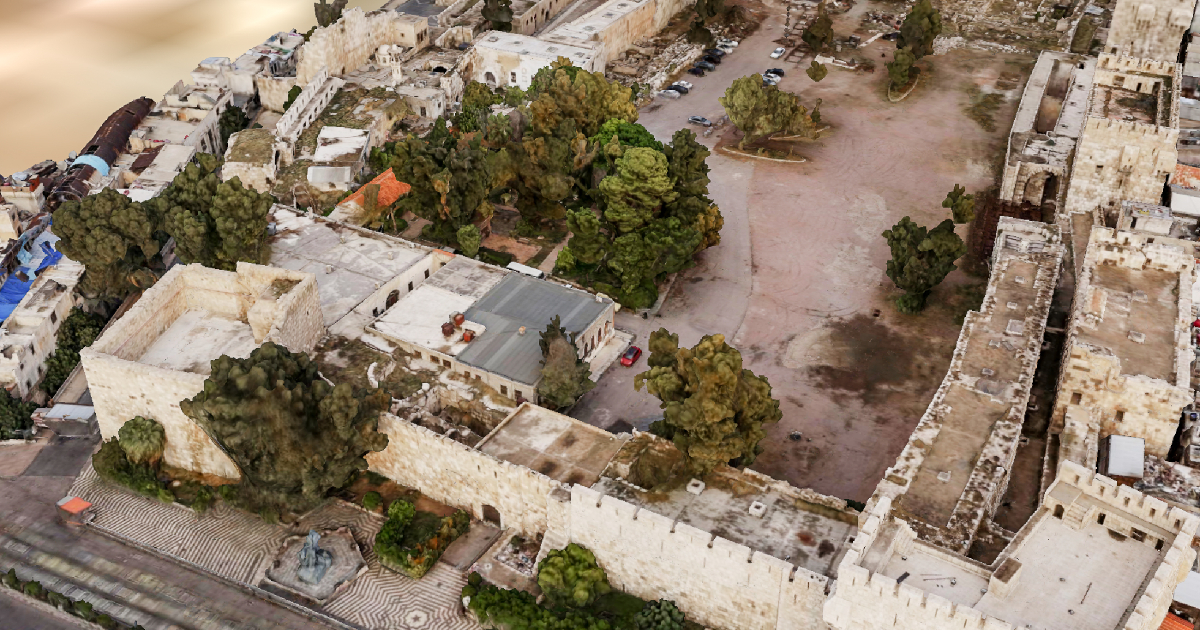
Geoscan Group and experts from the Institute of History of Material Culture of the Russian Academy of Sciences (IIMK RAS) have completed a 3D model of the Citadel of Damascus.
The aerial photography was conducted in November 2020, the Сitadel was photographed using the Geoscan 401 and Gemini. The images were then processed and converted into a 3D model using Agisoft Metashape.
The 3D model of the Citadel of Damascus has already been transferred to the Directorate General of Antiquities and Museums of Syria (DGAM). It is planned to be used for the restoration works on the site. The model is also available to view online.
The history of the Citadel of Damascus is quite rich. It is a UNESCO World Heritage Site, one of the oldest surviving fortresses in the Middle East. The historians concluded that the citadel construction began as early as under Emperor Diocletian (3rd - 4th century AD). The fortress was completely destroyed in the 10th century and reconstructed in the 11th century, when the territory was occupied by Seljuks. In the 12th century, it was damaged by the earthquake, after which it was reconstructed and new fortifications were added to the old ones. Some fortress walls and buildings were destroyed after the siege by the Mongols in 1260 and by Tamerlane's troops in 1401. At the beginning of the 14th century, the Citadel along with other territories of Syria became a part of the Ottoman Empire. In the XIX century, the fortress began to lose its military purpose, and until 1986 it was used as a prison and barracks.
Earlier, experts from Geoscan and the Institute of History of Material Culture of the Russian Academy of Sciences carried out a large-scale project in Syria to create a digital model of Palmyra.