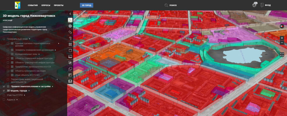
3D models by Geoscan may serve as a basis for a digital twin of populated area which clearly demonstrates interaction between various processes and parts of urban environment. It allows analysing infrastructure in a comprehensive matter and running it due to existing regulations and residents' interests.
Photorealistic georeferenced 3D models of urban and natural environment are created on the basis of aerial photography with a Geoscan UAV equipped with a professional full frame camera. After processing data in Agisoft Metashape Pro software, precise orthophotos, DEM and 3D models are formed.
Application fields

3D model of Nizhnevartovsk — learn more
Technology
Aerial survey can be performed with a camera or laser scanner, as well as with the use of both equipment,
which provides high detalization and realism of a 3D model.
Projects implemented
3D TOMSK, DIGITAL
URBAN DEVELOPMENT
The Tomsk Department of Architecture set the task to provide information and cartographic support for urban development. To solve this, it was necessary to obtain accurate geospatial data for the entire city, as well as to develop instruments for analysis, planning, assessment of urban planning solutions and their publication for citizens.


