Volume differences measurement
Volume measurement tools in Sputnik GIS are designated for analyzing the time-varying terrain elements. In GIS Sputnik positive (fills) and negative (cuts) changes in the relief are calculated, represented by two terrain models obtained at different times. Currently, the volume measurement tool only works on terrain models obtained by the Agisoft PhotoScan Pro software (GeoTIFF mosaic tiles in the kml/kmz container). You can also read the article about volumes measurement from the referenced surface.
Data and software requirements
- GIS Sputnik of 1.1.31841 version or higher
- Digital terrain models and an orthophoto in kml/kmz format
You can download the 30-day trial version of the program for Windows 7 / 8 / 10 (x64) on GIS Sputnik page or by the link
Demo data:
Two DTM and orthophoto in KMZ format
Open the orthophoto and terrain models files in GIS Sputnik by selecting File > Open in the main menu, then select the desired file in the "Open File" window and click the "Open" button, open other files the same way:
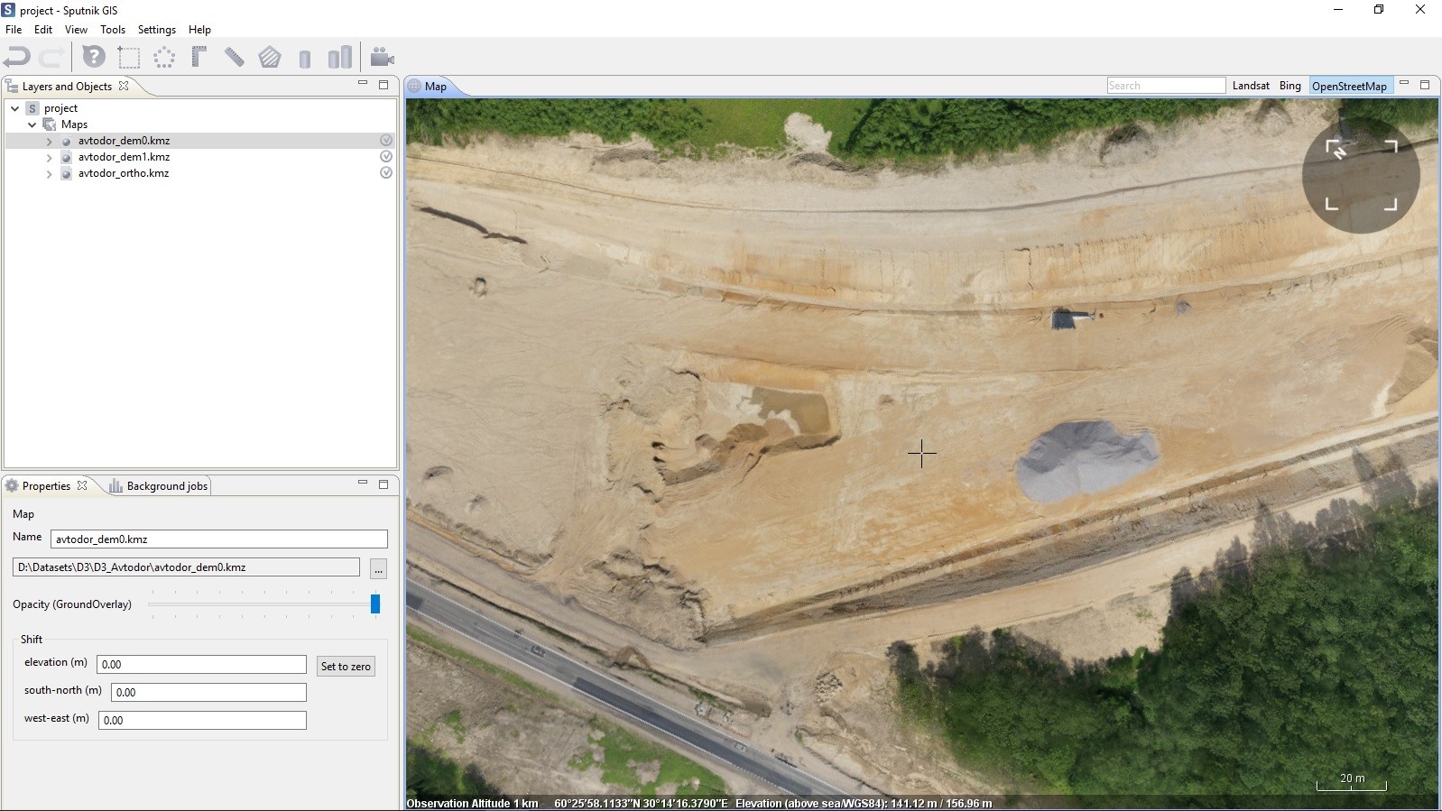
Opened files are displayed in the "Layers and Objects" panel. When the data is loading, a clock icon is displayed in the layer list next to the file name. To enable/disable the display of layers on the map with use of checkboxes to the right of the layer name (it is not recommended to include several overlapping DEMs at the same time). Mark the area (polygon) on the map, within which you want to measure the models difference:
- Click the "Volumes Difference" button to activate the selection tool
- Specify a polygon by marking the vertices of the polygon on the map
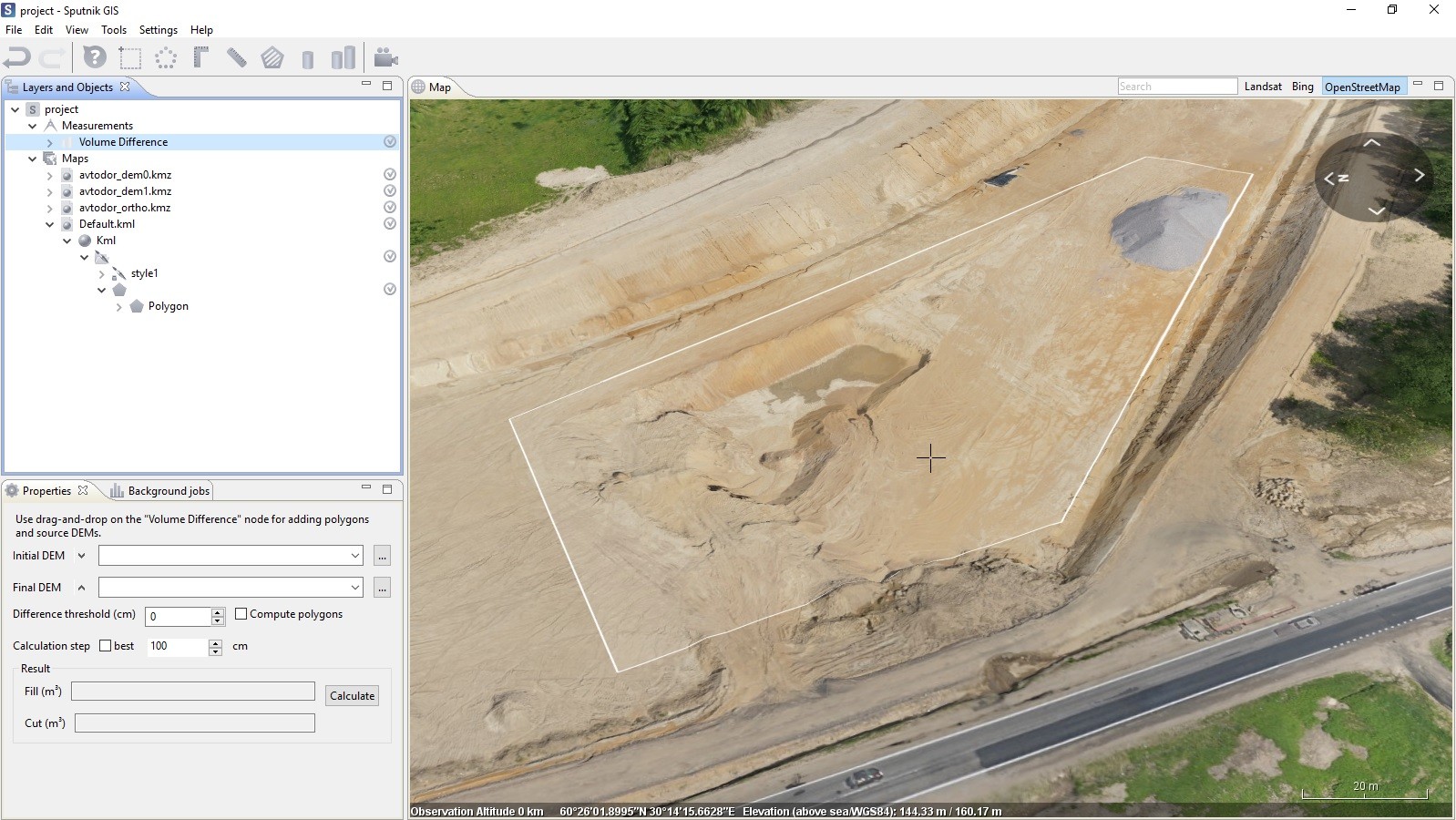
After the polygon is built, on the "Properties" tab, open the initial and final DEM in the appropriate fields on the "Properties" tab by dragging the DEM layers to the "Volumes Difference" line in the layer list:
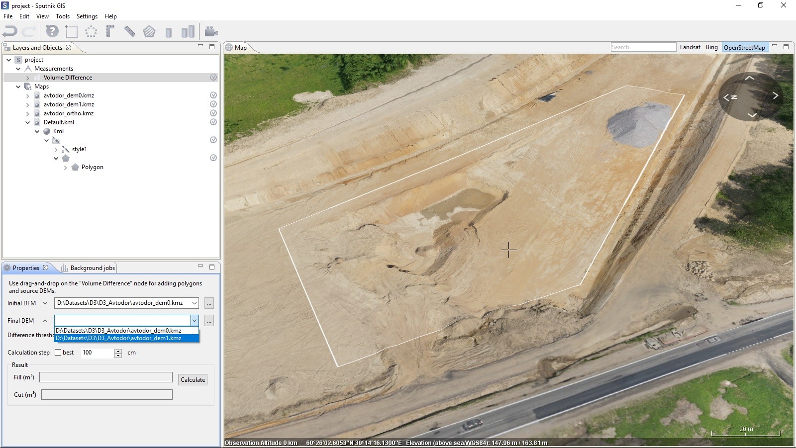
After both DEM models are specified, the calculation parameters must be set:
- It is possible to specify the difference threshold (in centimeters), when a drop is less than this valuse, the site will not be included in the final calculation of the volumes difference.
- It is also possible to specify a calculation step or select the option "Best"
- If necessary, it is possible to compute polygons illustrating the areas of formed fills (red) and cuts (blue).
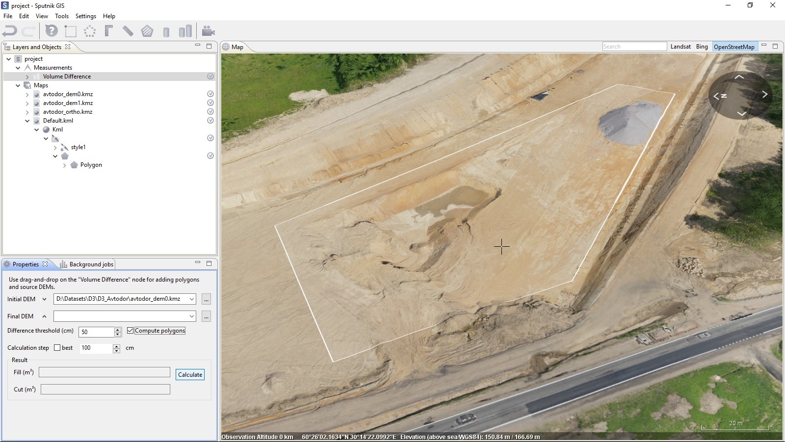
Processing will take some time, depending on the selected parameters: with decreasing the step and minimizing the thershold, the calculation time increases, and vice versa. After the calculation is completed, the amount of positive and negative changes on the terrain surface will be displayed in the "Fill" and "Cut" fields in the "Properties" tab (the "Volume differences" object), and, if the "Compute polygons" option is activated, the polygons, corresponding the sites of fills and cuts, are highlited on the map:
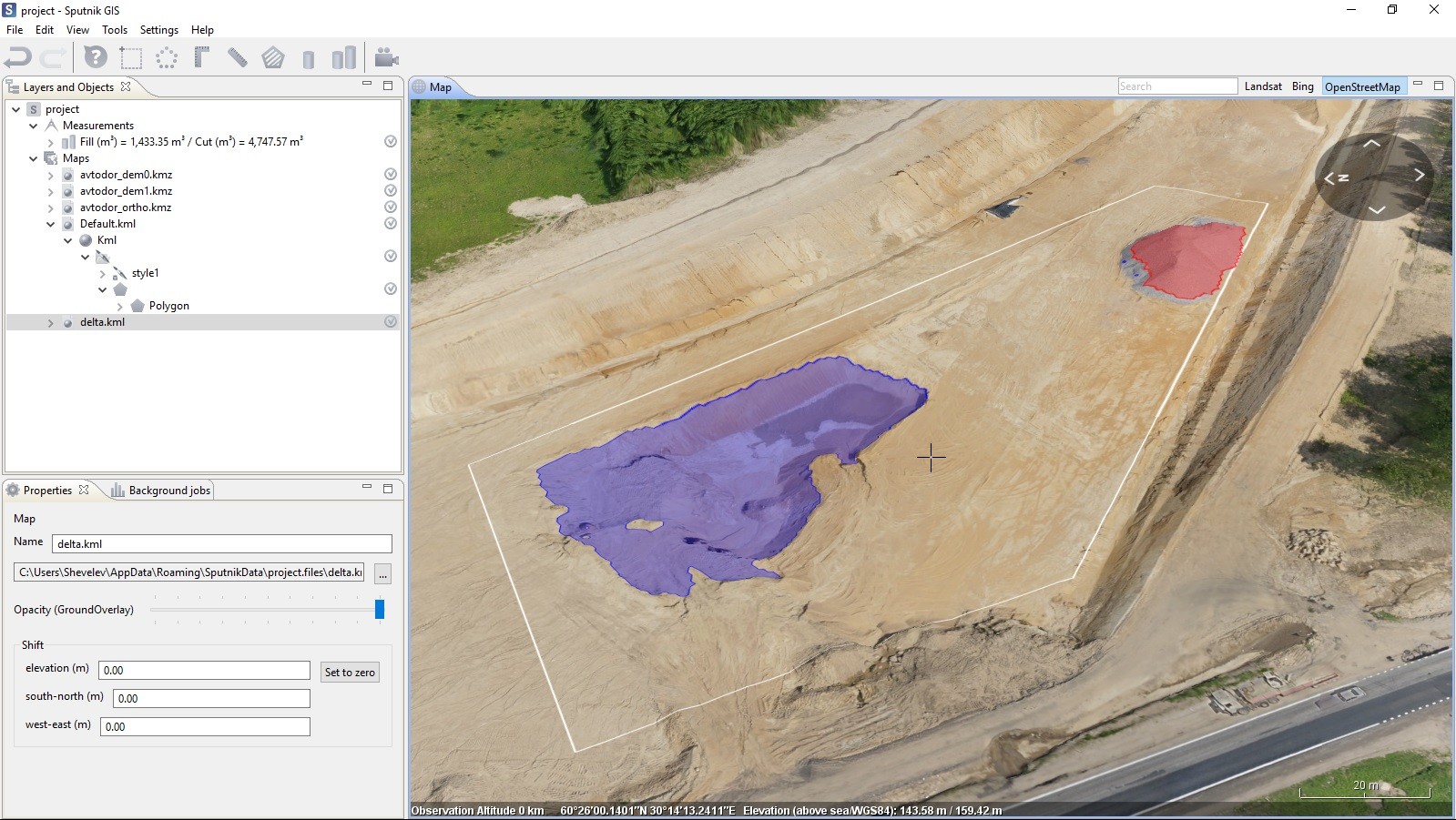
To completely reset the measurement results, all data from Default.kml and delta.kml must be deleted and closed, as well as the "Difference volume" object from the "Measurements" layer of the "Layers and objects" window.
More information on application of GIS Sputnik is available by the link
