Until recently, the following methods were used for solving classic mine surveying tasks, including the determination of the volume of loose materials in open storages and the amount of excavation in quarries:
- instrumental, consisting in conducting a tacheometric survey of the object of interest, for example, a pile of wood chips in a storage. This method is the most time-consuming and expensive, and it may also put the field staff at risk in the workplace.
- Remote, for which the data can be obtained with a laser scanner (ground or aerial), as well as with an aerial photography with a manned aircraft (LA) and specialized aerial photography equipment. This method involves buying or renting expensive equipment and aircraft, training and keeping staff of qualified specialists, and also method depends on weather conditions.
The modern level of technology development, particularly in an area of unmanned aircraft and in an area of affordable by the quality and price of photographic equipment, allows to find ways of creation of new technologies based on such equipment, what significantly reduces the financial and time costs of performing mine surveying tasks.
A prominent representative of the Russian and International UAV market segments is "Geoscan" group of companies, which possesses all the necessary elements of technology of its own production for solving the problems of mine surveying.
Let us consider in more details the composition of software-hardware systems and technologies of the company.
Geoscan developed unique software-hardware systems, which includes the following components:
1. Unmanned aircraft vehicles (UAV), the technical characteristics of which are illustrated in [Fig.1].
Fig. 1. «Geosccan» UAV technical characteristics.
These systems have a number of advantages over their competitors, specifically:
• High level of flight safety;
• High productive efficiency of each of UAV type in its segment;
• Ease of operation;
• Safe for environment (electric motors);
• Low noise level;
• Maximum level of automation of control with availability of manual control;
• Affordable price.
The payload that is installed on the UAV varies depending on the purpose of the survey. As a rule, for topographic and mine surveying tasks, mirrorless cameras with central shutter are used, with a focus of 20 to 35 mm and a matrix size of 16 to 24 MPix. Geoscan UAV are equipped with the Sony DSC RX-1 cameras, which are calibrated and modificated for proper control and power supply.
For the purposes of agriculture and forestry, additionally, Sony Alpha A5000 cameras modified for multispectral surveys are used. A thermal imager is used to monitor fires, power lines, etc.
In order to obtain camera centers, coordinates of which are necessary for photogrammetric triangulation, Geoscan UAV is equipped with high-precision GNSS geodetic receivers "Topcon B110", or similar. Detailed characteristics of Geoscan complexes are available in description.
2. The second key component of the complex is "Agisoft PhotoScan Pro" software, designed for processing of aerial survey data in an automated mode with minimal involvement of the operator.
The software allows creation of the dense point clouds (analog of the result of laser scanning), orthophotos, digital terrain and elevation models, as well as high-quality textured photorealistic 3D models of the objects based on digital photos.
A wide range of formats for export and import allows you to interact with many programs, like GIS Sputnik, AutoCAD, Mapinfo, QGIS, Photomod, etc.
3. The third key component of the complex is "GIS Sputnik" software - a modern three-dimensional geoinformation system that allows to visualize and analyze geospatial information in a single 3D space, with taking into account temporal dynamics.
The main functions of the program are: visualization and analysis of orthophotos, DEM, DTM, including analysis of metric data of the objects, calculation of positive and negative forms of relief with the possibility of changing the characteristics of objects surveyed at different times.
"GIS Sputnik" can be used for assessment of the pipelines and power lines condition (deformations, detection of illegal structures, condition of soils and calculation of tree and shrubbery vegetation volume), monitoring of road condition and calculating the volume of mining products, cuts and fills, etc.
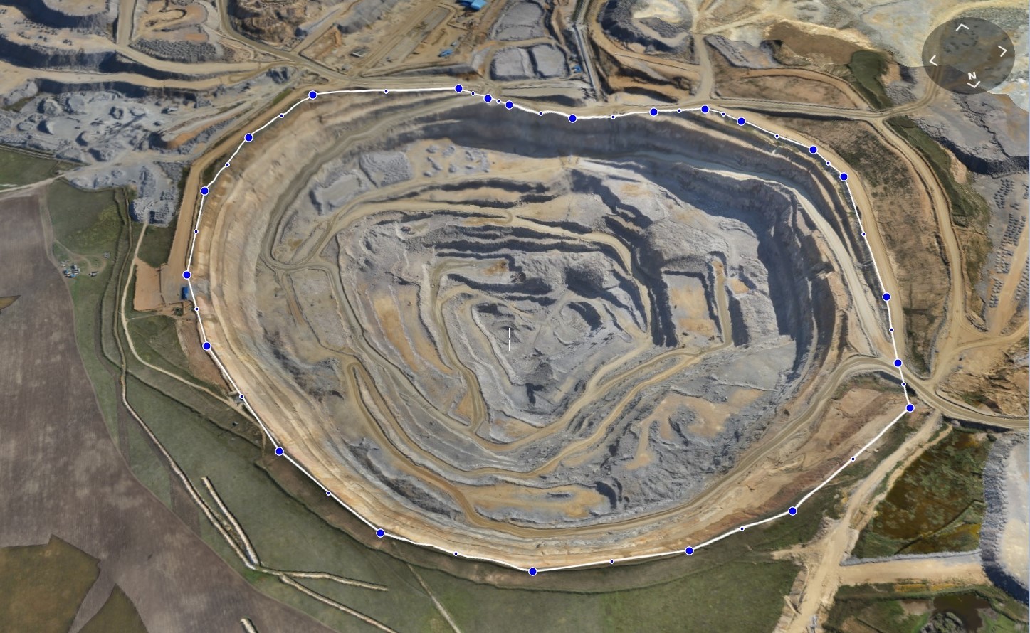
The process of determining the volume of mining products at the ore quarry in "GIS Sputnik" interface is shown in [Figure 2].
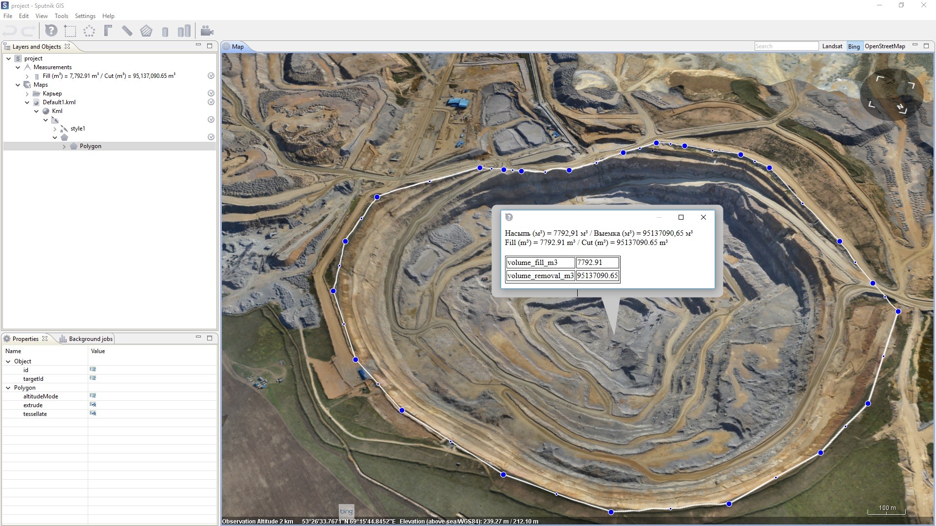
Fig. 2. The process of determining the volume of mining products at the ore quarry in "GIS Sputnik" interface
Software and hardware systems based on "Geoscan" UAV find their application in the following areas:
1) Topography - maps and plans creation on the basis of aerial photography materials: orthophotos, DTM and DEM;
2) Mine survey - determination of volumes of mining products in quarries, as well as loose materials in open storages, etc.
3) Forest industry - determination of the volumes of logs at lumbermills and open storages, monitoring of the forests state, identification of illegal loggings, multispectral monitoring of the forest species;
4) Agriculture (with use of NDVI index).
5) Monitoring of construction;
6) Monitoring of forest fires, floods;
Based on the capabilities of the software-hardware systems, the following technology has been developed that can be applied for the purposes of mine surveying (for example, for determinination of the volumes of loose materials at open storages):
I. Preparation.
• Obtaining permits for oerforming aerial works;
• Storages boundaries determination;
• Setting and measurement of the control points (the image of the compilation survey marker and the compilation survey points placement scheme are depicted in [Figure 3]);
• Preparation of aerial survey projects.
II. Aerial photography.
• Search for takeoff and landing points for UAV;
• Installation of a base station (GNSS receiver, static mode);
• Carrying out aerial photography;
• Preliminary data examination in the field for availability and completeness.
III. Desk works.
• Processing of geodetic data (acquisition of camera centers);
• Photogrammetric processing of aerial photos, obtaining orthophotos, DTM and DEM, an example of a DEM of sand piles at the open storages is shown in [Figure 4];
• Accuracy control;
• High-precision textured photorealistic 3D model of the object building (sand piles), an example of the 3D model of the object is shown in [Figure 5];
• Export of the data to the geoinformation system.
IV. Analytical work in the geoinformation system.
• Measurement of the volume of the object.
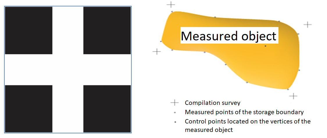
Fig. 3. The image of the compilation survey marker and the compilation survey points placement scheme.
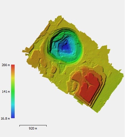
Fig. 4. DEM of sand piles at the open storages in «Agisoft PhotoScan Pro» interface.
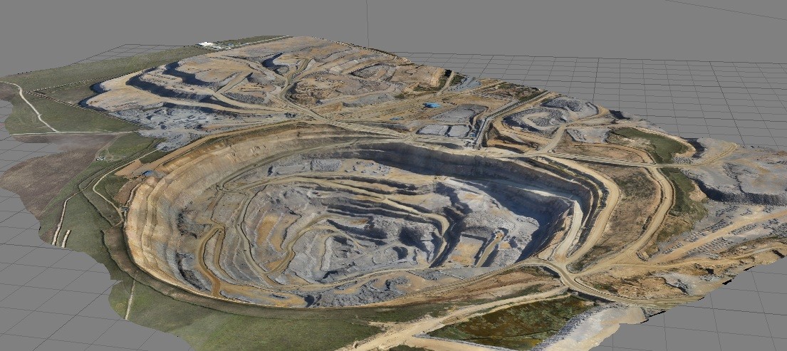 Fig. 5. Image of 3D model of sand piles at the open storages in «Agisoft PhotoScan Pro» interface.
The technology developed by "Geoscan" group of companies has been repeatedly tested at many industrial facilities. The results of tests showed that the determination of the volumes of materials with the use of UAV is comparable to the quality of the instrumental measurements (the discrepancy of values was 1% of the volume), and by the completeness of the information obtained, they are superior. The accuracy of the object model was 0.05 m horizontally and 0.1 m vertically, which indicates the high accuracy of the method.
The main advantages of Geoscan technologies are:
- High accuracy of the received materials;
- Work execution speed and efficiency;
- Software and hardware systems components have been developed and produced in Saint-Petersburg, Russia;
- Minimal labor costs in comparison with traditional survey methods;
- The availability of technology for the specialists of different profiles (does not require deep knowledge of geodesy, aerial photography, mapping).
This features allow to increase the efficiency of surveys and to benefit from the resource savings with regular monitoring of loose materials in open storages.
In order to confirm the results and the effectiveness of the technology, Geoscan conducted voluntary certification and research tests of the software-hardware complex in specialized organizations.
It should be noted that modern UAV manufacturers usually offer piecemeal solutions: they produce only unmanned systems or exclusively software, which does not allow to create a complete technology, where each component fits to each other.
Geoscan complexes include all the necessary elements of the technology ensuring the acquisition of aerial photographing data, its processing and analysis, which allows to create completed solutions for modern business, optimize costs and simplify the service of each of the elements of the software-hardware complex.
Also, Geoscan technologies are available as a service, so the specialists of the company carry out surveying works at the enterprise.
In connclusion, we can say, that Geoscan technologies proved to be reliable and efficient at the problems of mine surveying. Accuracy (the discrepancy of values was 1% of the volume), and ease of operation makes it possible to recommend Geoscan technologies for use in mine surveying.
Kurkov Mikhail Vladimirovich, head of the research department, "Skan" ("Skolkovo" innovation center resident) from "Geoscan" group of companies, E-mail: m.kurkov@geoscan.aero;
Semenov Aleksey Evgenievich, CEO, "Geoscan" group of companies, E-mail: a.semenov@geoscan.aero;
Kotov Artem Alexandrovich, head of the geodetic department, "Titul" from "Geoscan group of companies, E-mail: a.kotov@geoscan.aero
