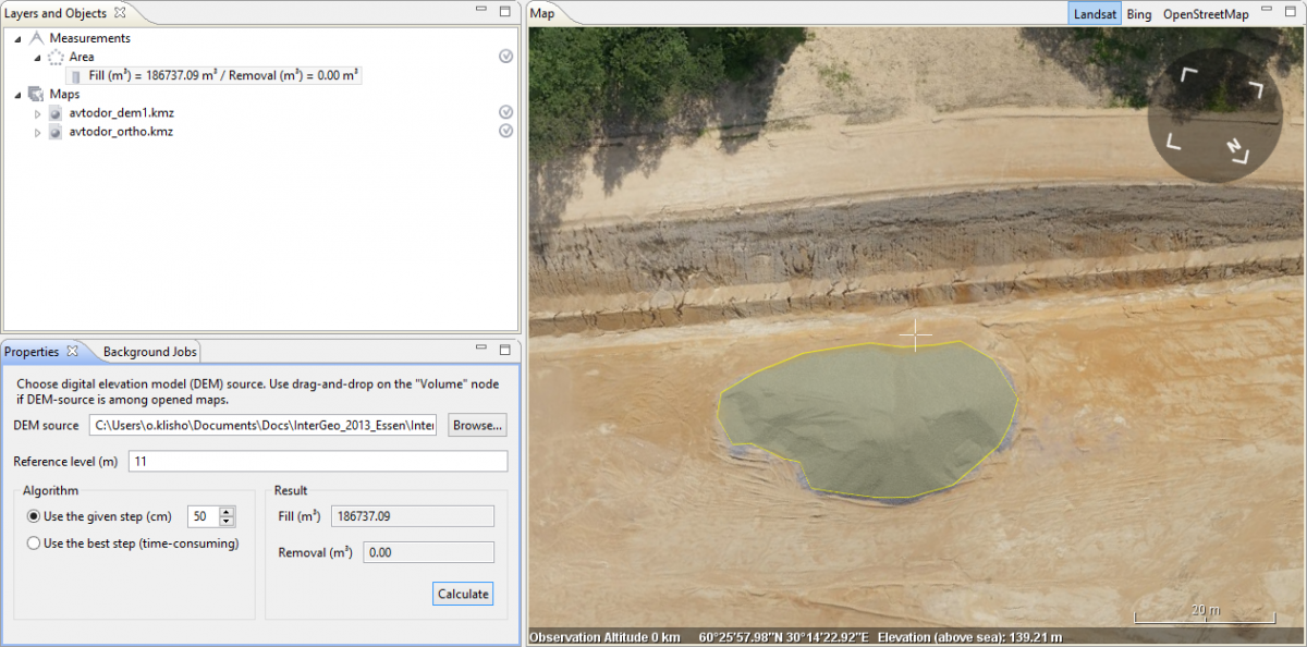
Volume measurement tool is developed and spread in new GIS Sputnik release. Now it allows to calculate both positive and negative deviations from a Reference level using only one digital surface model within selected area.
You can get acquainted with measuring deviations of the digital surface model in comparison with another model in the tutorial: "Volume measurements in Sputnik".
Calculating volume from reference level:
- After building the polygon press
 to activate the Volume tool. It will add ?Volume? child element to the selected "Area" element in ?Layers and Objects? list.
 - Select initial DEM source using Browse button and Open file dialog in ?Properties? pane or simply by dragging the corresponding layer to the Volume element in ?Layers and Objects? pane:

- Set the Reference level you want to calculate difference from. If the reference level isn?t set, the height of the lowest polygon boundary point will be used by default.
- Press Calculate button after DEM and Reference level are selected, calculation may take a while, you can follow the process with the progress bar, that will occur in the right top corner:

- You may set fixed grid size for volume calculations using ?Use the given step? and ?Use the best step? options in ?Algorithm? section. The former lets user set grid step manually, the latter uses native DEM resolution.
- After calculations are finished the positive deviations from the Reference level will be shown in the "Fill" field and negative ? in the field "Removal".
If you have any suggestions according volume measurements or succendent developement of GIS Sputnik tools, please send it to info@geoscan.aero
