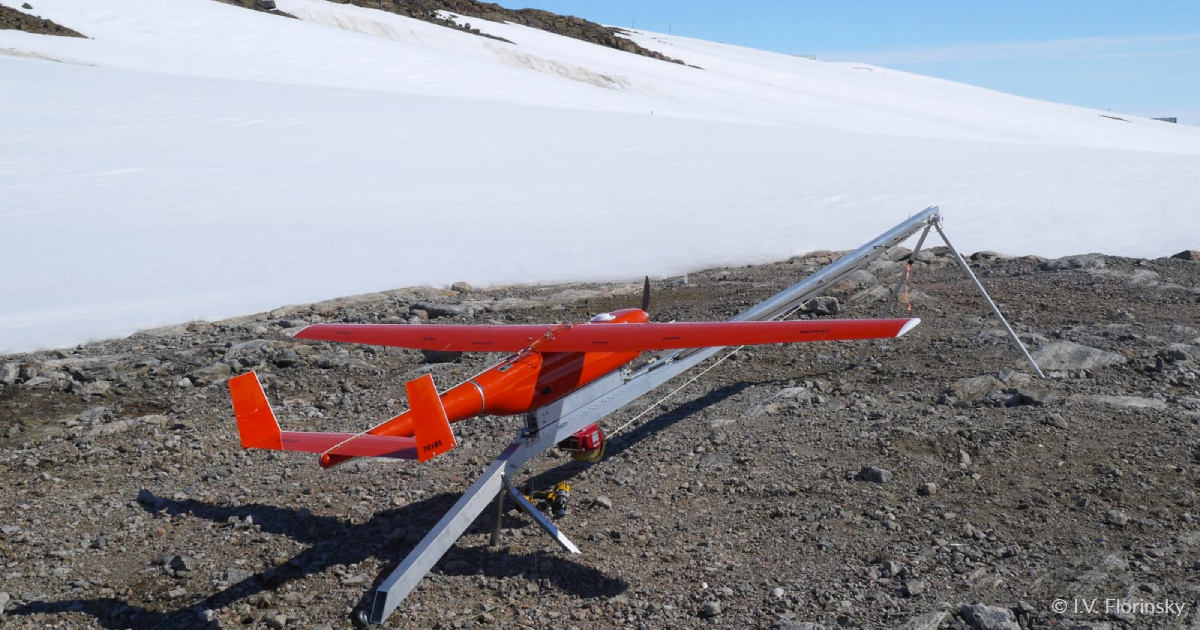
At the end of last year, a Geoscan pilot as part of Russian Antarctic Expedition (RAE) embarked for the South Pole. The purpose of the trip is aerial photography to obtain cartographic materials of hard-to-reach areas of the glacier and the study of the albedo of various types of snow-ice surfaces.
Before the trip our staff member had to study in order to get a seaman‘s book. For this, he attended a two-week course consisting of both theoretical and practical classes with breathing equipment and life-saving appliances in a pool. After our specialist received required documents, including medical, and prepared the UAVs, he got ready for an expedition of several months.
RAE members were making their journey in the scientific research vessel Akademik Tryoshnikov sailing along the route Petersburg — Bremerhaven — Cape Town — Antarctica. At the end of December, it laid at anchor in harbour of Cape Town after covering about 8500 nautile miles for 30 days. The team replenished provisions and fuel there as well as celebrated New Year.
15 January 2022, the vessel reached Antarctica. The Geoscan specialist and RAE scientists were flown to Molodyozhnaya Station by helicopter. They were expected to survey thousands of hectares, and they succeeded in this task thanks to Geoscan 701, which is an unmanned aerial vehicle with maximum performance, achieved by using a professional camera and high speed.
Geoscan 701 key characteristics
| Max flight time | 10 h |
| Max coverage in one flight | 7000 ha (3 cm/px) 25 000 ha (10 cm/px) |
| Wing span | 3.3 m |
| Flight speed | 80-120 km/h |
| Max take-off weight | 22 kg |
| Max payload weight | 3.5 kg |
| Max route length | 1000 km |
| Max flight altitude (above sea level) | 4500 m |
| Four-stroke petrol ICE | 40 сm3, 3.75 hp |
| Take-off preparation time | 30 min |
| Take-off/landing | from the launcher / by parachute+ballonet |
| Temperature | -20 to +40°С |
| Case dimensions | 170×68×30 cm |
That day the weather was perfect for survey: clear cloudless sky, the South-Southwest wind, 2 m/s on the ground and at cruise height, with the temperature +3° С on the ground and approximately –5° С at cruise height.
To launch the UAV, the team chose the nearest snow and ice-free area whereas the GNSS-station was placed on a hill top. After an hour assembly and setting, Geoscan 701 took off to the Antarctic skies. The modem, placed on the roof of the nearest building, was supporting the communication between the ground station and the UAV.
Geoscan 701 flight was as smooth as silk, and after several hours the UAV safely landed not far from launch point.
Maiden Antarctic flight characteristics
| Flight time | 328 minutes |
| Coverage | about 8000 ha |
| Altitude | 700 m |
| Number of images | 1981 |
| GSD | 9 cm/px |
| Overlap | 70% (frontlap) and 50% (sidelap) |
The UAV surveyed the territory between two stations, Molodyozhnaya and Gora Vecherniya including the stations themselves and nearest islands. After photogrammetric data processing the orthomosaic map with ~10 cm resolution and digital surface model with ~25 cm resolution will be received. They will help to track the appearance of cracks in the ice sheet of Antarctica, the dynamics of ice sheets and outcrops of bedrock in the coastal regions of the continent.
These days, our pilot is working at another station — Bellingshausen. Besides Geoscan 701 he utilizes Geoscan 401. We are going to tell you about his work at this area next time.
