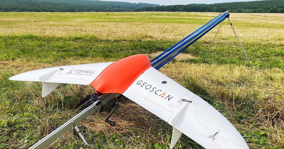
For the first time Russian drone successfully transmitted location and telemetry data to the Gonets Satellite System data center. Additionally, a command for forced return to the launch site was sent to the UAV via satellite. Gonets Satellite System JSC (part of Roscosmos) and Geoscan held this joint experiment at the “Archipelago 2024” project-education intensive in Sakhalin. These highly-demand technological solutions enable the tracking of drone locations in areas lacking other ways to communicate.
The testing procedure used a Geoscan 201 unmanned aerial vehicle, carrying a Gonets experimental modem and a specially designed lightweight antenna. From July 13 to July 16, 2024, drone pilots carried out ground tests and flights at the “Pushisty” airfield. They assessed the possibility of establishing a connection, transmitting telemetry data from the UAV to the Gonets-M spacecraft. Finally, they tried sending commands from Geoscan’s ground control station to the UAV via satellite. Over the course of six flights Gonets system FTP server received a total of 218 drone telemetry messages, as well as transmitted back to UAV three messages with control commands.
“Satellite communication systems with nationwide coverage open much broader technological horizons for UAV development. Control systems for unmanned aerial complexes, monitoring their location, status, and flight zone permissions are advancing to a new level, significantly reducing the risk of UAV loss. Today’s event represents a new era in UAV solutions, as satellite technologies enter this industry, maximizing its potential for innovative applications. This includes beyond-the-horizon control of all types of drones, a new level of monitoring, and the ability to receive required data from flight zones. I am confident that more opportunities will emerge, which we may not yet fully appreciate,” noted Pavel Cherenkov, General Director of Gonets Satellite System JSC.
“Given our country’s vast expanse, with significant part of its territory having no other way of communication but through satellite, while the demand for UAVs remains high, it is crucial to develop satellite systems for tracking the location of drones. Space technologies will expand coverage for aerial photography surveys and allow for adjustments in UAV flight parameters during emergencies. Due to their multifunctional nature, satellite systems are far more promising and cost-effective investments than ground-based infrastructure. As a developer and operator of unmanned systems, Geoscan is interested in such solutions, and we were eager to join this experiment,” commented Alexey Yuretsky, General Director of Geoscan.
