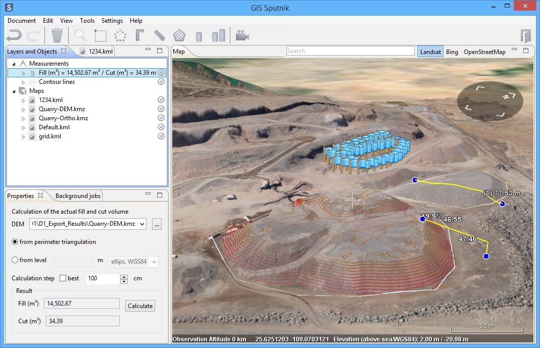
Sputnik GIS allows to perform different kinds of measurements and analasys of KMZ and GeoTIFF digital terrain models and digital elevation models:
- Measure elevation, slope, distance or surface area of DEM
- Measure cut and fill volumes
- Compare two DEMs of a region captured with a time interval
- Build customizable contour lines
- Make a kriging-interpolation for DSM to DTM transformation
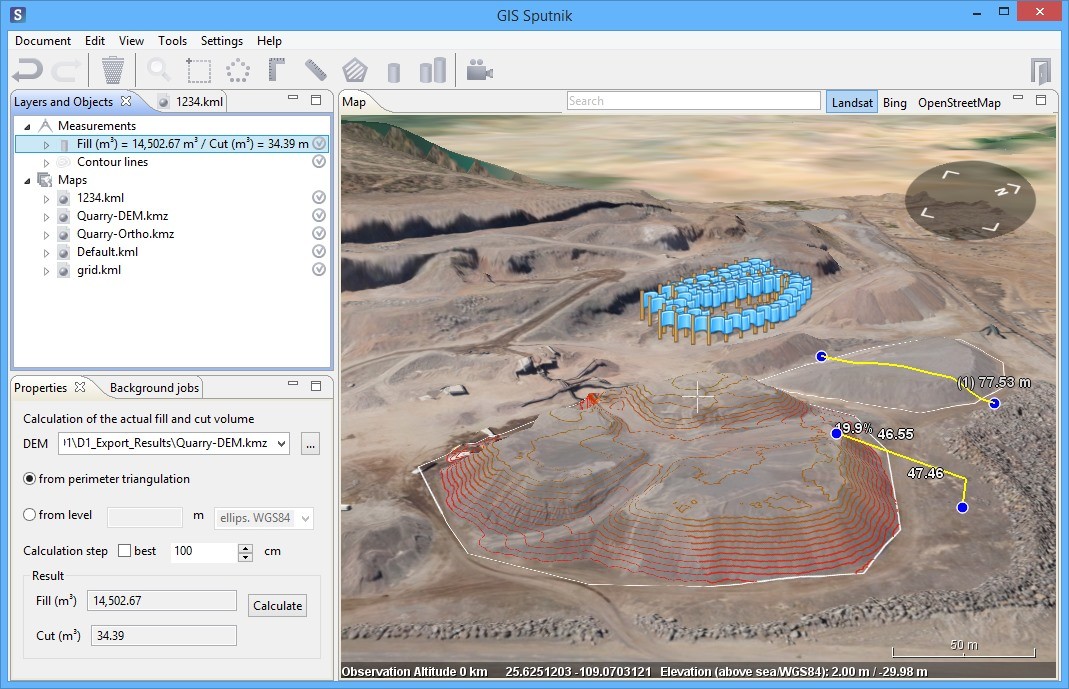
You can download 30-day trial version of Sputnik GIS for Windows 7 / 8 / 10 (x64) at the Sputnik GIS webpage or use direct link
Also, you can download sample dataset for the next tutorials in KMZ or GeoTIFF data format.
Measuring distances, slopes, elevations, areas in Sputnik GIS
To measure elevation, slope, distance or surface area you can use the range of tools: ?Corner ruler? (1), ?Ruler? (2) and ?Area? (3).

?Corner ruler? tool displays slope, horizontal distance, actual distance and elevation between two points located at an ortophotomosaic / DEM / DTM. Press ?Corner ruler? button and select 2 points by clicking the left mouse button. Now you can see the ruler with all parameters calculated:
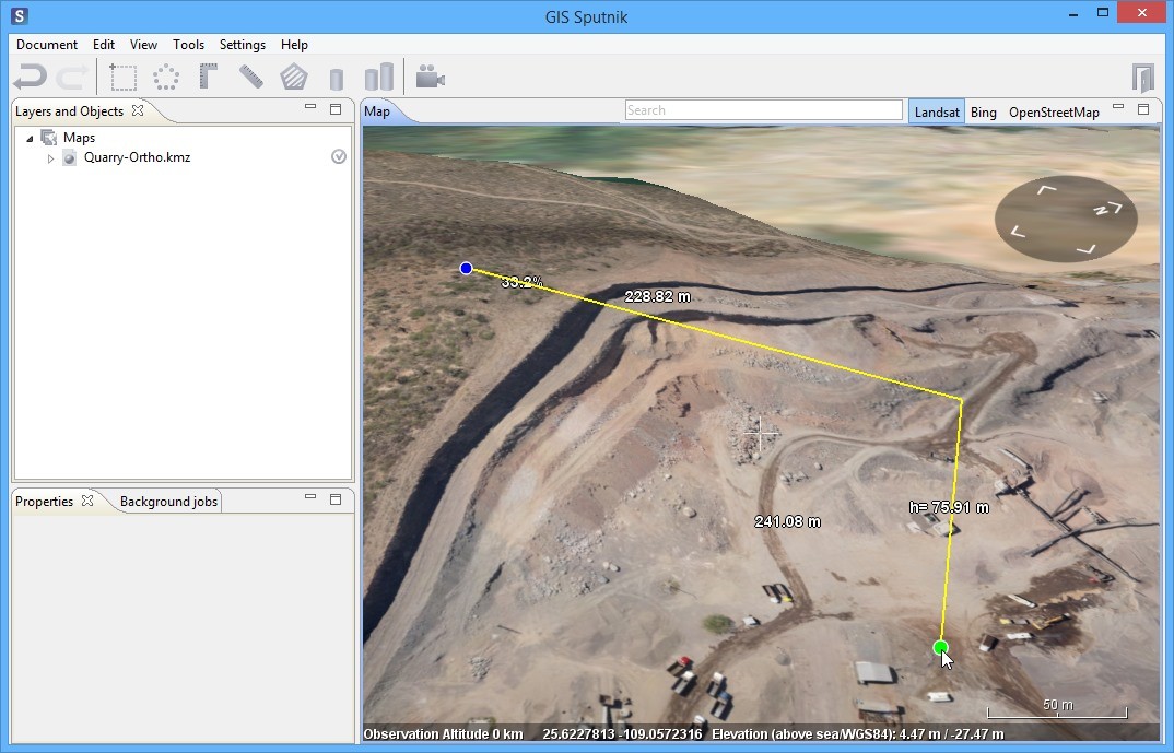
You can move selected points while using ?Ruler? and ?Corner ruler? tools and watch how parameters are changing. Move the cursor to the point and after color is changed, move the point by the surface, holding left mouse button pressed.
Press ?Corner ruler? button twice to reset measurement results.
?Ruler? tool displays distance between two points located at an ortophotomosaic or DEM. Press ?Ruler? button and select 2 points by clicking the left mouse button:
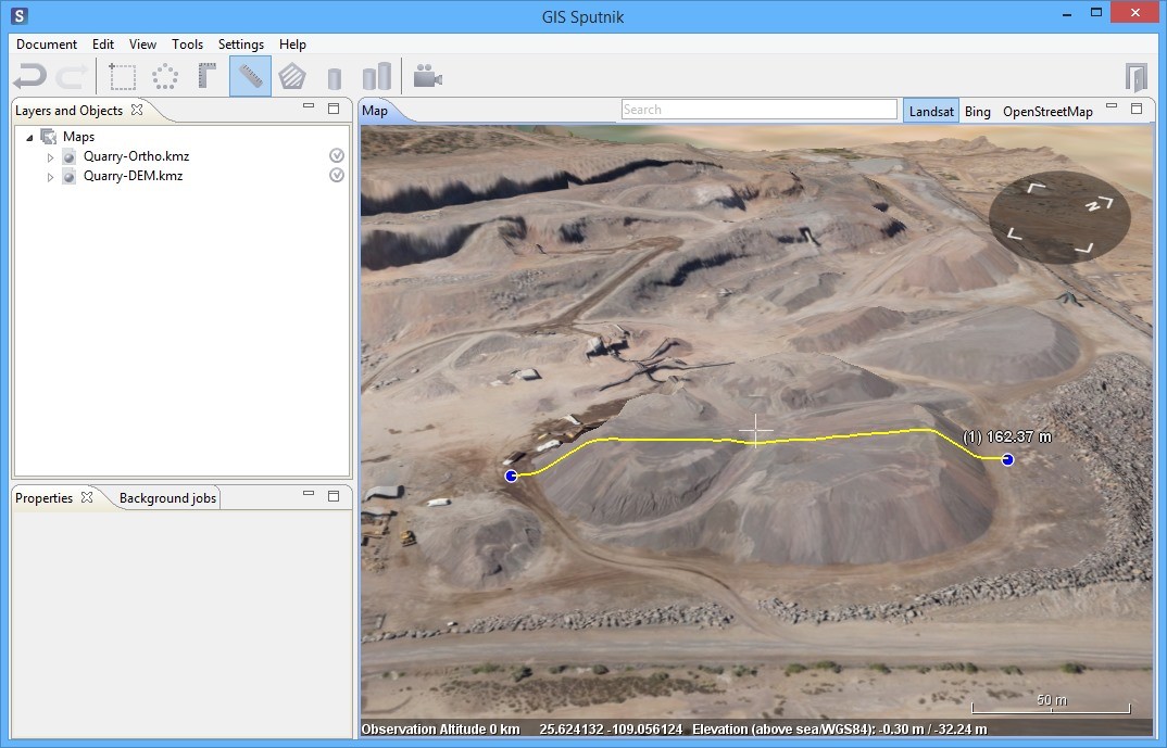
Press ?Ruler? button three times to reset measurement results.
?Area? tool displays surface area of 2D projection of a polygon, located at an ortophotomosaic / DEM.
Press ?Area? button and create a polygon by selecting three or more points at a surface of DEM:
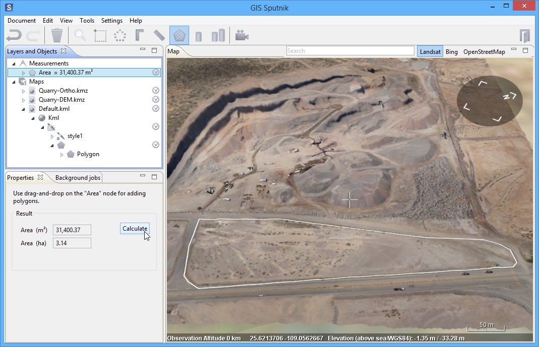
Area value recalculates every time you add a new point. After polygon creation is finished, its total square in square meters and hectares can be viewed in the ?Properties? window.
It is possible to save the polygon created to KML file and load it again to display the previously calculated value of an area. Click at the Default.kml item of ?Layers and Objects? list using the right mouse button and select ?Save as??.
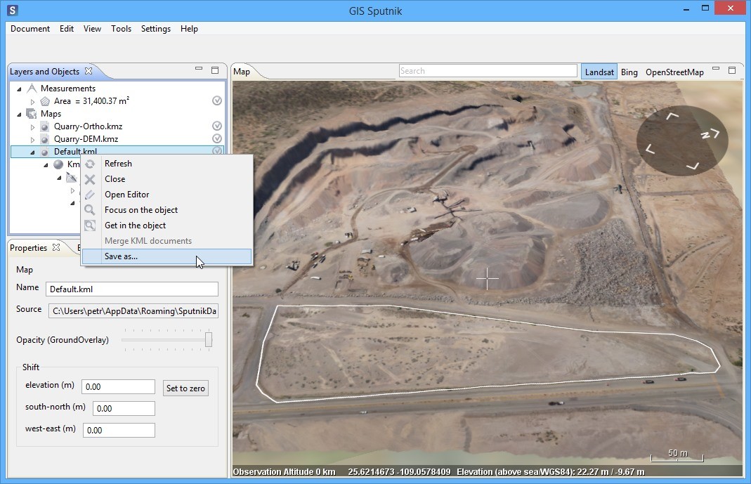
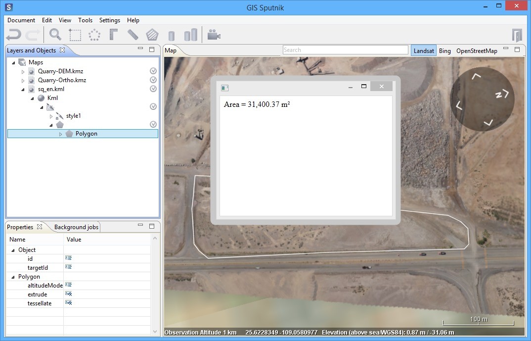
Select a path to save KML file. Next, after opening KML file you have saved, it is possible to display an area value. Select ?Tools? ? ?Information? option and then click the left mouse button on a polygon loaded:
To reset measurement results it is necessary to delete all data of Default.kml and close it and then remove ?Area? from ?Measurements? folder of ?Layers and Objects? list.
Build contour lines with Sputnik GIS
?Contour lines? tool displays lines, which connect points with similar elevation values.
Open ortophotomosaic and DEM by clicking Document > Open, then select files and press ?Open?.
Select Tools > Contour lines user menu option:
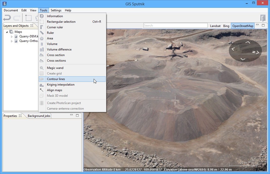
Create the polygon to build contour lines within it:
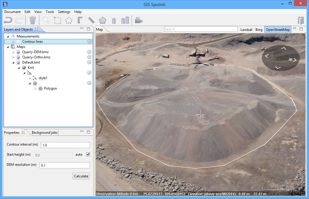
It is possible to set a value of contour interval (elevation between neighbor contour lines) and DEM resolution (distance between neighbor points in a contour line). In addition, start height can be set, if necessary.
Performance tip: the more surface area you have selected, the more should be values of contour interval and DEM resolution to keep optimal calculation performance.
After settings is complete, press ?Calculate? button of ?Properties? window. When calculation is finished, contour lines are displayed inside the polygon selected:
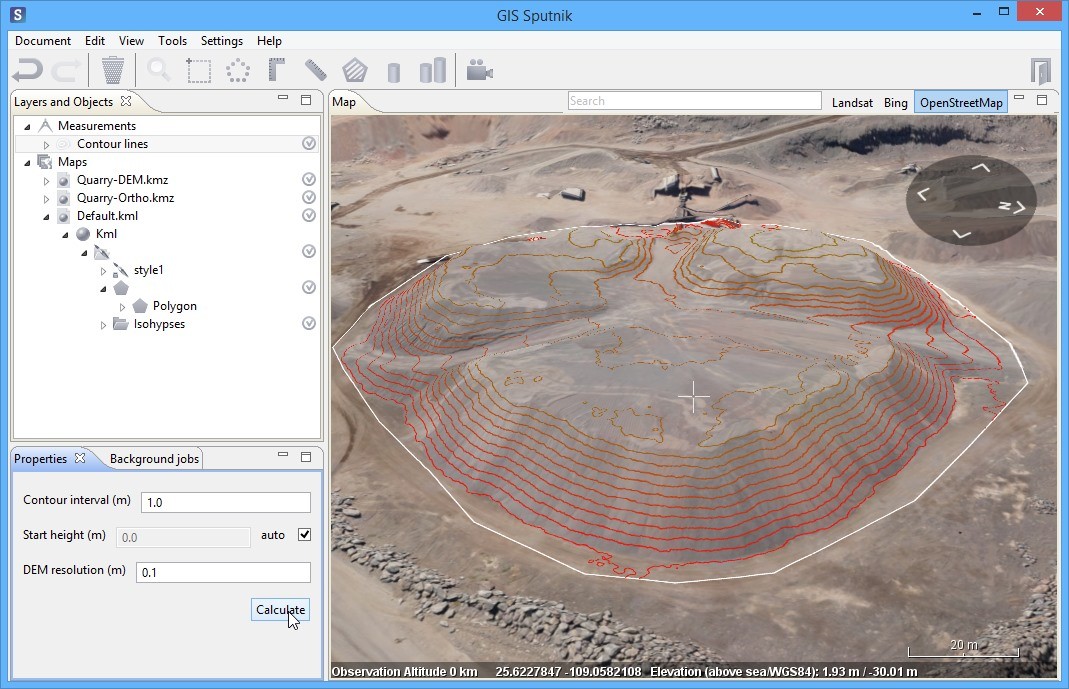
It is also possible to save calculated contour lines to KML file and display them again. To do that click the right mouse button on Default.kml item of ?Layers and Objects? list and select ?Save As??. By opening the saved file you can view the contour lines, you have created previously.
To reset measurement results it is necessary to delete all data of Default.kml and close it and then remove ?Contour lines? from ?Measurements? folder of ?Layers and Objects? list.
Using Kriging interpolation in Sputnik GIS
?Kriging interpolation? tool of Sputnik GIS performs transformation of digital surface models to digital terrain models. The tool, for instance, can give a good result in extraction of DTM from a DSM, containing sparse forest area.
Open ortophotomosaic and DSM by clicking Document > Open, then select files and press ?Open?.
In this example kriging interpolation will be used for calculation of estimated elevation values under the pile.
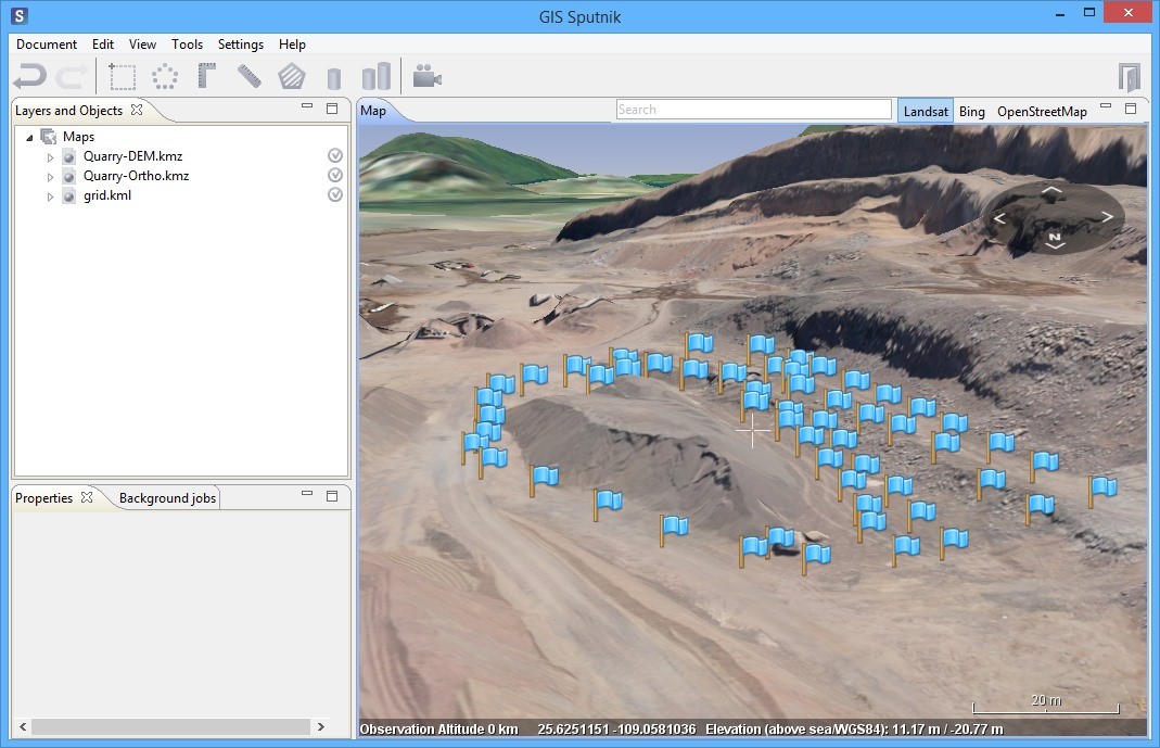
You will need a KML file with a grid of points to interpolate elevation values. You can create it by clicking Document > New KML document and place the points using ?Create Point? button, which is showed automatically after a new KML file is created.
Build a dense grid of points near to a pile, but do not including the pile itself:
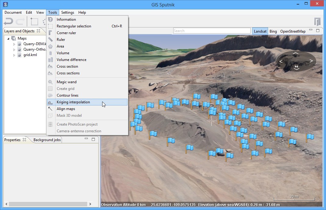
Select Tools > Kriging interpolation user menu option:
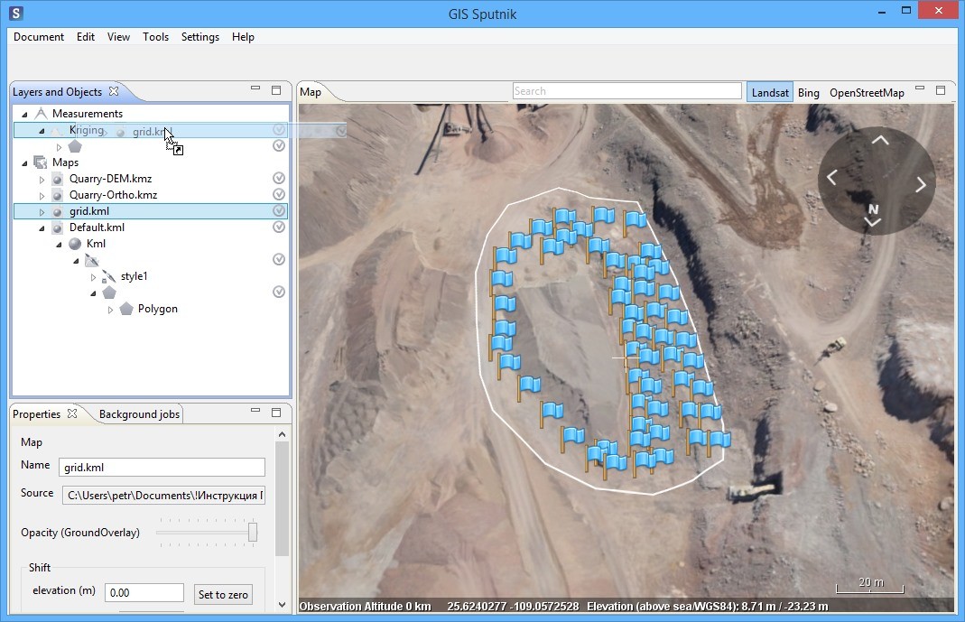
Create a polygon to perform kriging interpolation within it. Drag KML file with a grid of points from ?Maps? folder to ?Kriging? object of ?Measurements? layer:
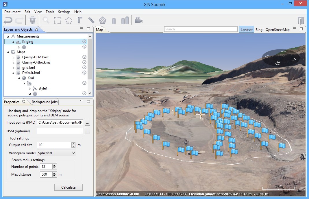
Next, you can setup Kriging parameters and select DSM to transform its selected area to DTM:

TIF file save dialog will appear after you press ?Calculate? button of ?Properties? window. This file contains a GeoTIFF DTM for an area you have selected. Choose a path and press ?Save?.
After calculation is completed, DTM area will automatically appear in the ?Map? window and ?Layers and Objects? list.
You can load the GeoTIFF file again later, it is available in the folder you have saved it previously.
To reset measurement results it is necessary to delete all data of Default.kml and close it, then remove ?Kriging? from ?Measurements? folder of ?Layers and Objects? list and close GeoTIFF file.
