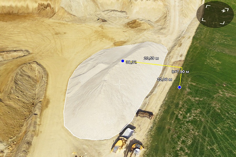
To learn about volumes measurement from the reference surface read our article.
1. Create a new KML file ( File-> Create->KML…).

2. After creating the file, GIS Sputnik automatically switches to the editing mode. Click the kml icon with the left mouse button, in the main panel icons will appear, allowing to create a point or line, ring and polygon.

3. Click the  icon and draw a simple line in the supposed area of the construction of the rough (reference) surface.

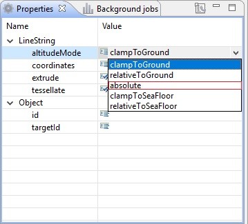
In the tree of created kml the “LineString” object appears, click on it with the left mouse button and in the "Properties" window in the altitudeMode section and select "absolute".
4. Right-click on the "LineString" object and select "Edit coordinates".
5. Open the text file with the points obtained as a result of instrumental surveys. Insert the points into the "Edit Coordinates" window.
- The points must be in the WGS84 coordinate system
- The separator between the integer and fractional part of the coordinates is a comma
- The separator between coordinates - a space or tabulation
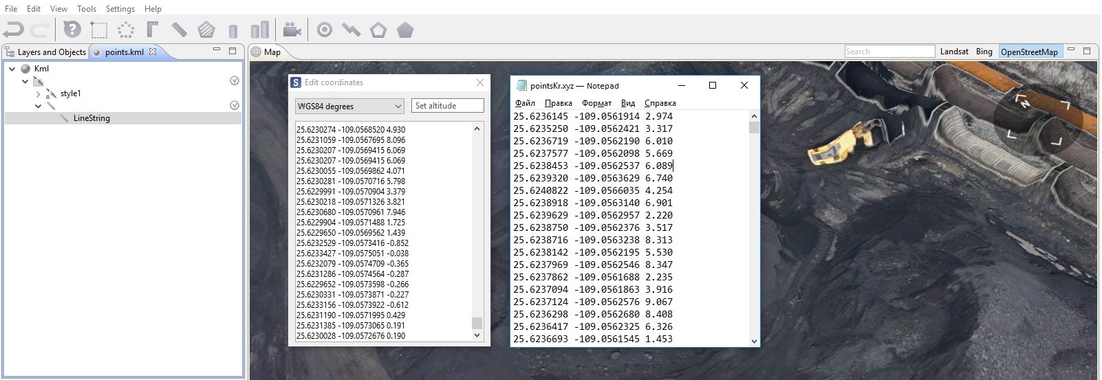
Close the "Insert coordinates" window.
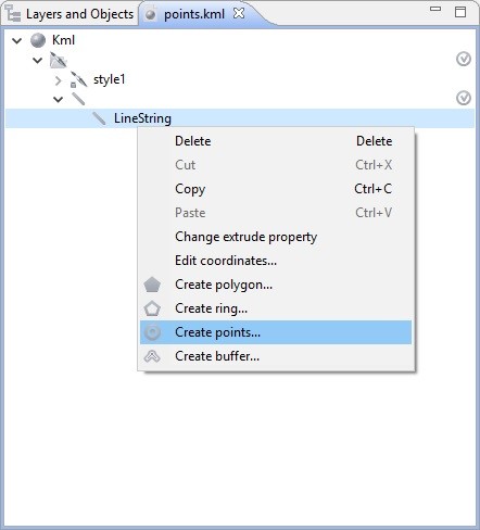
6. Right-click on the "LineString" object and select "Create points"
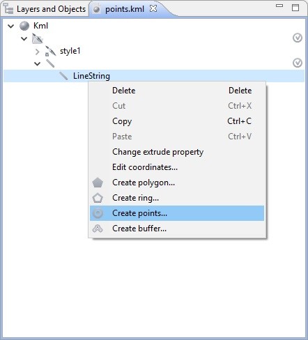
7. Delete the "LineString" object by right-clicking it - > Delete. Then go to the "Layers and objects" window by left-clicking it.
8. Select Tools -> Kriging interpolation in the main menu.
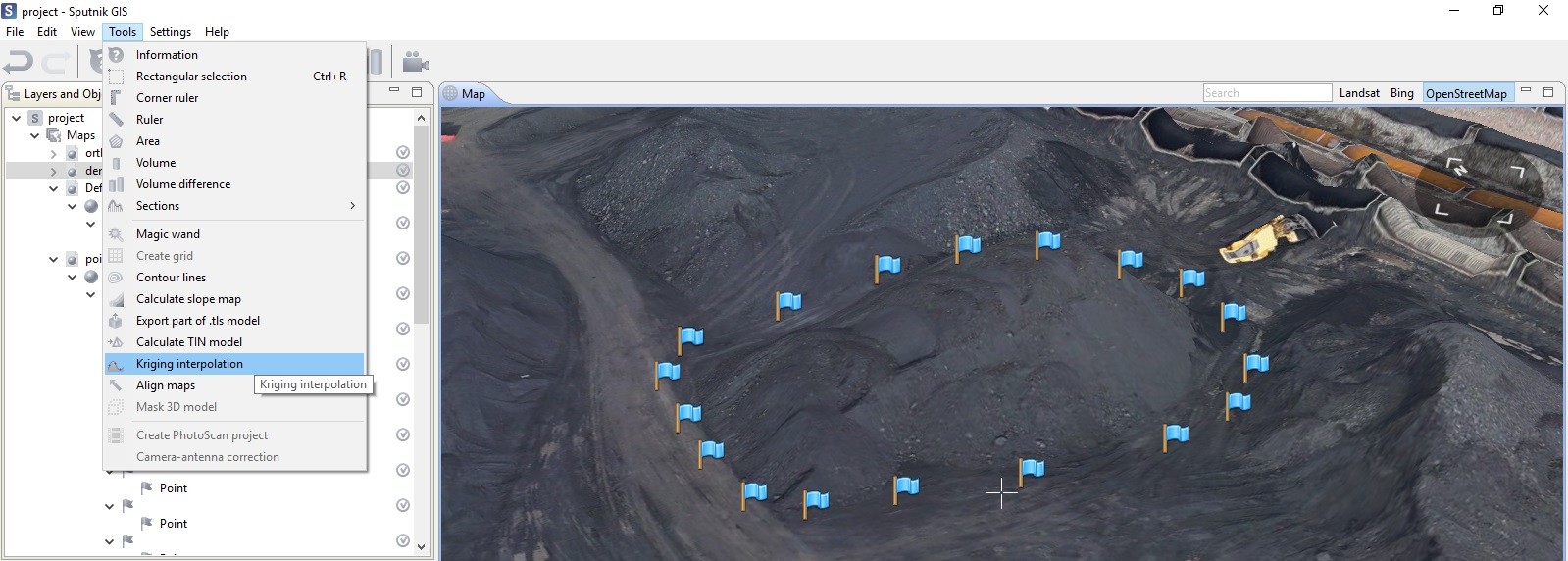
Draw the supposed zone of construction of the rough (reference) surface.
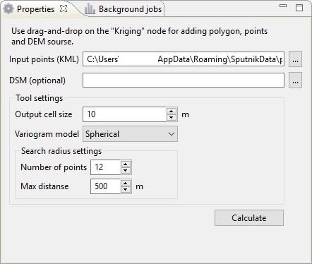
9. In the "Layers and objects" window drag your points layer to the "Kriging" tool.

10. In the "Properties" window set the size of the output cell (the smaller the cell, the more accurate the reconstruction of the reference surface is) and click "Calculate".
Leave the "DSM" field empty if you want to use only instrumental surveys for building a rough (reference) surface.
In the "Layers and objects" window the calculated rough (reference) surface appears.
11. Click the  icon (volumes difference) in the toolbar. Draw an area for calculations or in the «Layers and objects» window drag the polygon, which was used for building the rough (reference) surface from the "Kriging" tool to the "Volume diffrerence" tool.
In the "Properties" window in the "Initial DEM" field select the reference DEM (specifically, the previously created rough surface), in the "Final DEM" field select the surface for which the volume calculation will be performed. Click "Calculate".
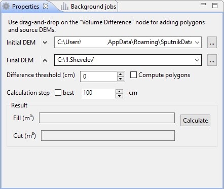
12. The "Volumes difference" tool will show calculated Fill and Cut values.

.
The possibilities of application of GIS Sputnik for solving similar tasks are described in the user manual in the examples: 6, 8, 13, for other purposes - follow this page.
